My shopping cart
Your cart is currently empty.
Continue Shopping

Credit: Munda Biddi signage - Miles Arbour (Bikepacking.com)
Navigating the Munda Biddi Trail
For safe and effective navigation, we recommend using the following tools:
Both MBTF and DBCA advise using tools 1, 2, and 3 as your primary navigation sources.
For additional planning support, become a Foundation member and gain access to the Online Ride Planner.
Please take the time to read the navigation and safety advice below.
Trail Signage
The trail route is marked by distinct directional blue arrows on yellow posts, featuring the Munda Biddi 'message stick' symbol. The yellow posts can be easily seen while riding through the forest and in low light.
Navigation Tool Features
The Munda Biddi Trail combines two essential navigation tools: the Trail Maps and the Munda Biddi Trail App.
Trail Maps (paper)
The official Munda Biddi Trail maps, produced by DBCA, are available in the Biddi Shop and come in a set of 7, covering the entire Trail. The maps highlight key features such as car access points, campsites, terrain profiles, and distance tables. While the Trail is well-marked, cyclists are encouraged to use both the maps and the Trail App for complete navigation.
Map Pack/Series
The 7-map series is available for purchase at the Biddi Shop, bike shops, and visitor centres. The maps cover the following sections:
The map pack/series consists of 7 maps. The maps are also available for sale direct or local pickup from the Trail Hub, some bike shops and at regional visitor centres.
Munda Biddi Trail App
The App is a complete guide for planning, preparing, and navigating the Trail. It’s available from $26.99 (available to be downloaded for Apple/Android devices) and includes an active map that works offline, using GPS to track your location and show the route as you ride. Beyond navigation, the app serves as a guidebook, providing useful information about places along the Trail.
Key App Features
Refer the the Trail App page for further details.
Together, the maps and app are indispensable tools for any Munda Biddi Trail rider.
For basic alignment data the Parks and Wildlife Service provides GPX/KML files. Please carefully consider your sources of other online information and the currency of data.The Trail travels through remote areas and trail and environmental conditions can change rapidly, these sources maybe unreliable.
IMPORTANT NAVIGATION CONSIDERATIONS
Do not rely solely on digital navigation tools, as technology can fail and lead to misadventure. We strongly recommend using both the Trail maps and the Trail App together for reliable navigation.
Before setting off, test your device and navigation tools with a trial ride to ensure you're familiar with them—this will help you avoid learning how to use the map or app when you're already on the trail.
Keep in mind that phones and electronic devices need regular charging. Some apps can quickly drain your battery, especially when running in the background.
Please note, DBCA and MBTF cannot verify the accuracy of third-party data resources. Additionally, mobile reception may be limited along parts of the Trail, which could affect the functionality of navigation apps that rely on a signal.
Preparing to ride the Trail
For novice Munda Biddi riders, start out with an easy-to-navigate section close to a town, or practice on a well-signposted loop trail. Close to Perth, we suggest the Railway Reserves Heritage Trail for some smooth gravel riding, or the Kalamunda Mountain Bike Circuit. There is a wealth of information on the TrailsWA website.
Before each Trail ride
Get in the habit of checking the following websites to ensure you can access the most up-to-date information when you are riding the Munda Biddi. These sites are updated regularly by different levels of Government and are free of charge. We recommend that when you are on the Trail you periodically check these sites for the latest information.
Trail Diversions and Realignments
The Munda Biddi Trail App, via collaboration with the Munda Biddi Trail Foundation and DBCA, is usually updated to show the latest route and longer-term temporary redirections within a week or so of a change in the Trail route. DBCA does not officially guarantee the App is up to date. The official route is regularly diverted for various reasons - improvements, trail damage, flooding, forestry operations and bushfires.
These diversions are communicated on the ground by the Munda Biddi trail markers and temporary signs with detailed maps posted at the location. Diversions are also published via Park Alerts, although there can be some lag between conditions on the ground and the website.
The App and DBCA’s GPX and KMZ files are not updated with temporary diversions.
There are ongoing works to improve the Munda Biddi Trail, including minor
and major realignments, which may take time to be reflected on the
official paper maps.
Permanent realignments that are not shown in the latest available map version (because they were implemented after map production) are posted on Park Alerts.
Permanent realignments are automatically shown on the Munda Biddi Trail App shortly after completion (Apps purchased before the realignment update to show the latest).
If you use paper maps, DBCA strongly recommends you mark them up with these realignments or print out the current alerts relevant to your Munda Biddi trip before your journey. If you use outdated maps, you can correct them using the archive of permanent realignments at this link below.
There are also two alternative routes that are available to ride as seperate trails off the Munda Biddi Trail.
DON'T RISK GETTING LOST!
If you suspect you've taken a wrong turn or feel uncertain about your route, always consult multiple navigation sources. As a rule, trust the trail markers—they provide the most up-to-date guidance.
Have a backup plan in place, especially since mobile phone reception can be unreliable and batteries can drain quickly along the trail. Carry the official paper maps and periodically check your position on them.
Be sure to sign into the logbooks at Munda Biddi campsites.
Above all, plan your route in advance and share your plans with family or friends before setting out.
Satellite Messengers
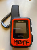
There are a multitude of devices such as the Garmin Inreach & Spot Tracker, that allow you to send SOS messages and texts via satellite networks, which will cover you where mobile phone signals don't. In most cases these devices allow you to communicate with your loved ones and let them locate your dot on a map (hence the term ‘dot watching,’ for ultra-endurance races.) You will need an active subscription to access these features on the device you choose. Check out some recent info, including 2022 reviews here, and get some more context on this style of device here.
The Bibbulmun Track Foundation hires out Garmin Inreach Mini devices to riders as well as bushwalkers. Refer to www.bibbulmuntrack.org.au